
Reading Culebra’s refuge habitats
Let vegetation, shore and bird habitat become part of the way you see the island.
Published 14 September 2026
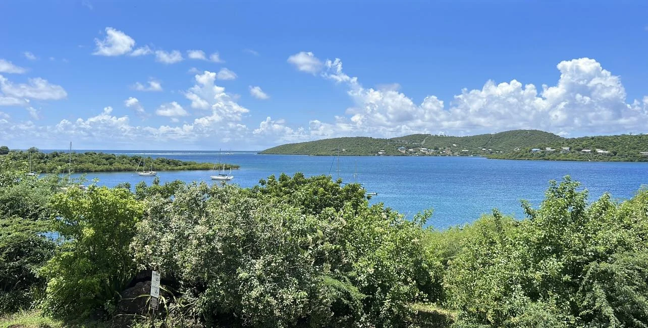
The U.S. Fish & Wildlife Service describes Culebra National Wildlife Refuge through a varied landscape that includes dry forest, mangrove patches, lagoons and offshore cays. That range is a useful correction to the idea of a Caribbean island as a single continuous beach scene.
Look at how those settings meet. A wider landscape may hold vegetation in the foreground, water beyond it and a line of hills at a different distance. You do not need to identify every plant or bird to notice that the coast has several layers.

Cave, Waterfall and River Adventure in Charco Azul from San Juan
This is an absolutely unforgettable experience. This day trip has it all: adventure, pristine tropical rivers, waterfalls, cave swimming, beautiful sc...

Half-Day Yunque Rainforest Waterslide & rope swing Guided Tour
Explore the rainforest on a journey full of history and natural gems. Drive yourself to meet your guide at Yagrumo R...

All Inclusive Snorkel and Slide Boat Tour: Icacos or Vieques
Spend five unforgettable hours cruising Puerto Rico’s northeast coast aboard our custom snorkel boat, complete wit...

ATV Single Rider Adventure Near San Juan - Hacienda Campo Rico
Hop on an ATV "Ride of a Lifetime." Share fun with family and friends on 4X4 machines, feel the power beneath you...
Keep habitat scale in the picture
The broad refuge photograph is dated circa 2024 by its source. It shows vegetation, hills and water together. No more precise bay or town name is established, so the caption remains at the refuge level.
A landscape photograph can help you become attentive to relationships between places. It does not identify a public route through every part of the frame. Use the refuge’s current visitor information and remain within the areas available for the activity you choose.
A small species illustration
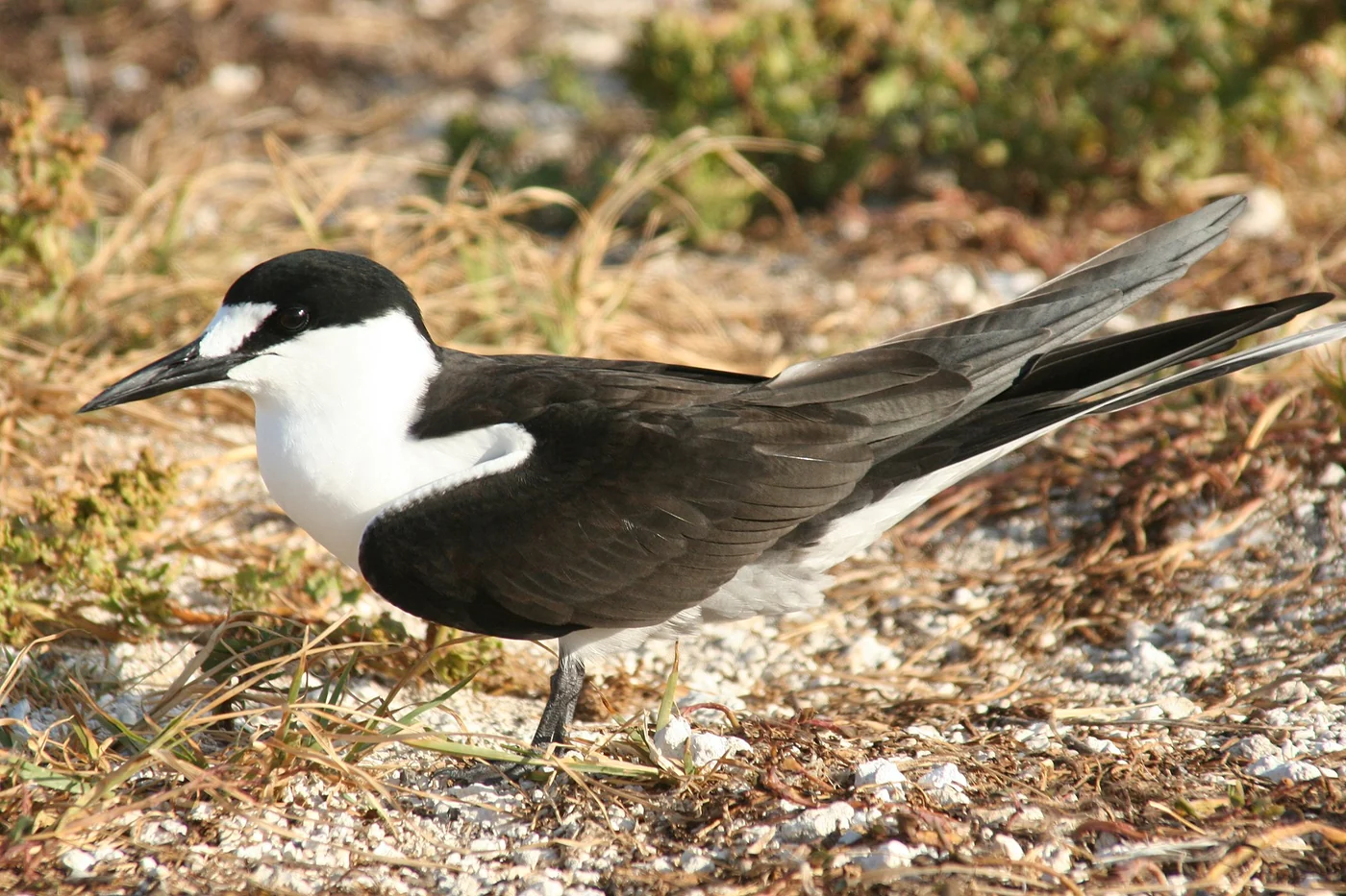
FWS publishes the sooty tern as the refuge’s ambassador species. The separate photograph by Duncan Wright/USFWS is dated 14 June 2006, but its capture locality is not established. It is therefore presented here as a species illustration, not as a claim that this particular bird was photographed on Culebra.
Seeing a species pictured in a guide is not a promise of an encounter. Observe from an appropriate distance, let animals move freely and avoid turning a possible sighting into a deadline for the day.
Read the current visitor guidance
Before visiting a protected area, consult the responsible authority’s current information for access, activities and any restrictions. The refuge offers a place to learn about these landscapes, but that does not make every cove, trail or offshore cay equally accessible.
If a guided activity is part of your plan, read the exact route and what it involves. Ask about the practical conditions that matter to your group, including the return arrangements. A general nature label cannot replace that information.
Leave room for quiet observation
Choose a manageable amount of ground to cover. Pausing to notice light through vegetation or the relationship between a shoreline and its surroundings can be enough. There is no need to collect an image of every habitat on one visit.
The island-life chapter includes a documented community cleanup moment, showing care for the coast as work carried out by real people. For a more specific shore choice, use the named beach comparison and keep its geography separate from this broader refuge view.
Sources and current information

San Juan to El Yunque Rainforest Waterslides and Luquillo Beach
Venture out from the hustle of the city, to El Yunque Rainforest and a more tranquil side of Puerto RIco. Indulge yourself in authentic experiences th...

Icacos Deserted Island Catamaran, Snorkel, and Picnic Cruise
Our catamaran takes you to the island of Icacos. Disembark and find yourself at a beautiful beach with crystal clear...

Night Kayak - Condado City Lights Tour
Our award-winning Night Kayak: City Lights Tour is unlike anything you’ve ever done before! Arrive and put on your...
El Yunque Rainforest Waterslides, Waterfalls and Rope Swing
Pictures, videos, bottle water—all included! Experience the best-quality service with local tour guides born and...
FWS refuge overview, current visitor information, the sooty tern source record. Consult the relevant authority or service for current arrangements. Photographs retain their precise source context.

Puerto Rico: Isla Verde Beach 2026 Brand New Jet Ski Rentals
Know before you go: - Please arrive at least 30 minutes before your reservation time - Drivers must be 18+ with a valid government-issued ID - Passeng...

Top Rated El Yunque Rainforest & Waterslide – SmallGroup Tour
Adventure into the rainforest on a historical journey where you'll discover various natural wonders. Complimentary t...

San Juan Guided Turtle Snorkel Tour and Complimentary Videos
Dive into the ultimate snorkeling experience in San Juan, Puerto Rico, where you can swim with sea turtles in clear...

Luquillo Beach Horse Ride from Carabalí Rainforest Adventure Park
Fulfil your dreams! This amazing 2.5-hour horseback tour will take you across the crystal clear waters of the Mameye...
Keep reading
Another island chapter.

Planning
Planning a considerate Culebra visit
Keep arrival, a suitable base and the return clear, then leave the middle of the visit open.
Read the guideCulebrita
Culebrita as a separate island
Treat a nearby island outing as a complete decision, with its own arrival, return and current conditions.
Read the guide